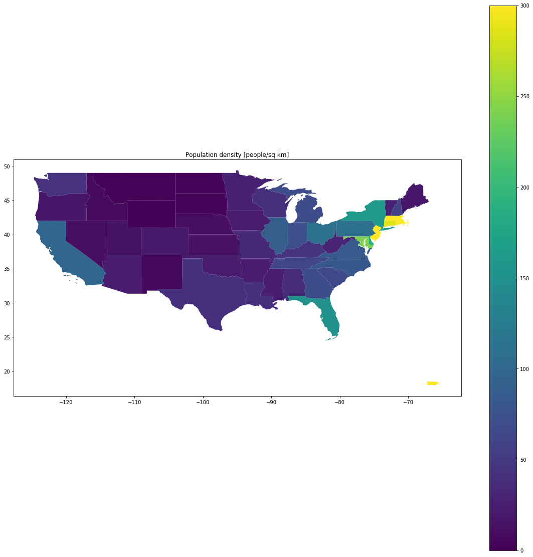
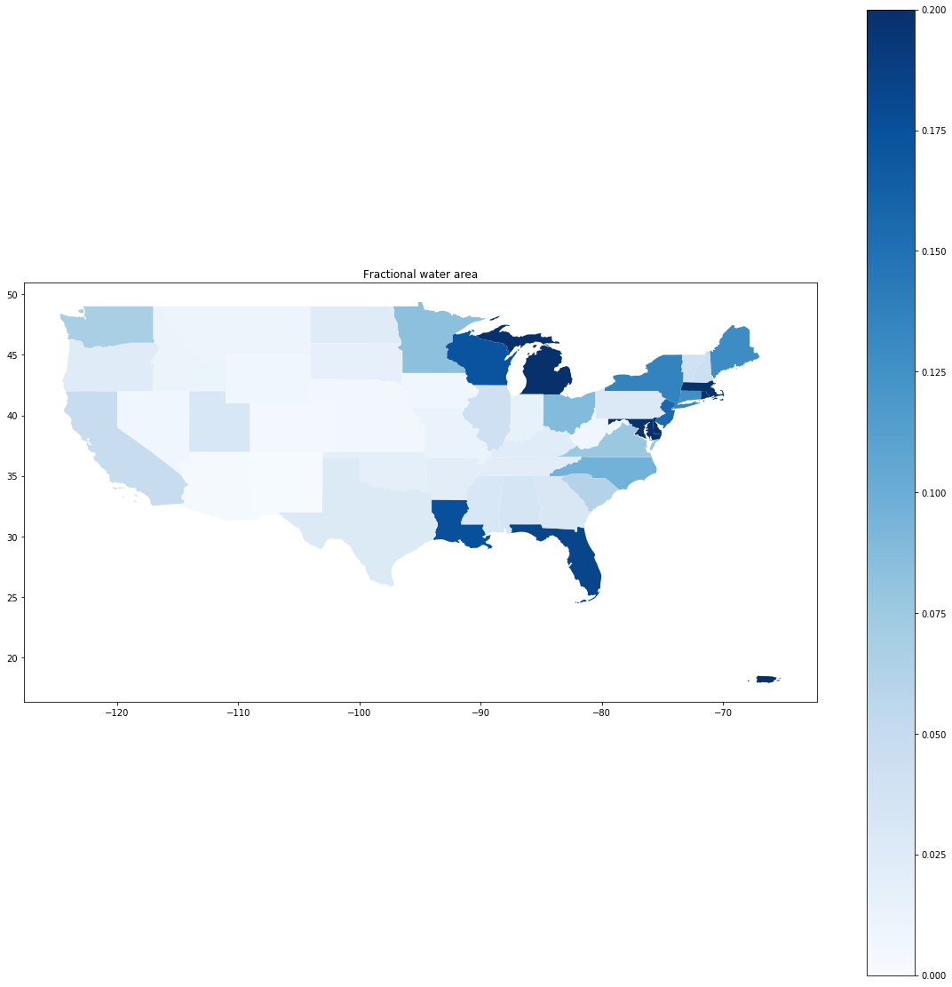
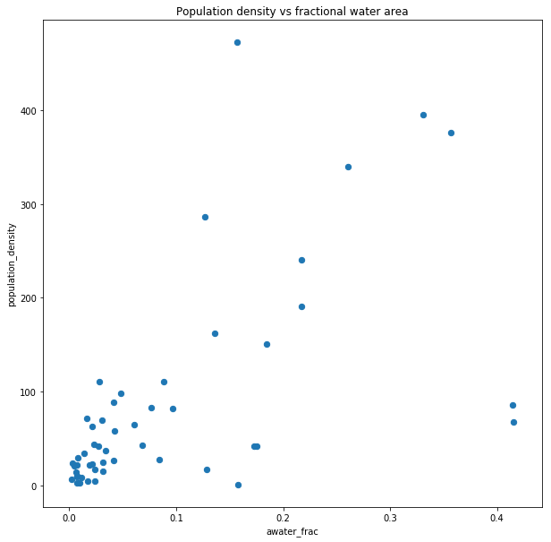
I made a Jupyter GeoPandas project to map some US census data.

population density choropleth map
United States population density map
fractional water area choropleth map
United States fractional water area map
population density vs fractional water area scatter plot
Population density and fractional water area are positively correlated.

github repository

https://github.com/beepscore/census_play

Github renders Jupyter in browser, but only for “Desktop Version”. If viewing on mobile device, you can scroll down and select “Desktop Version”.

US population density vs fractional water area